
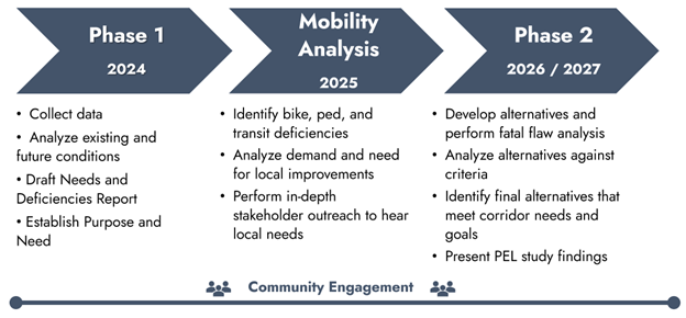
About this PEL Study
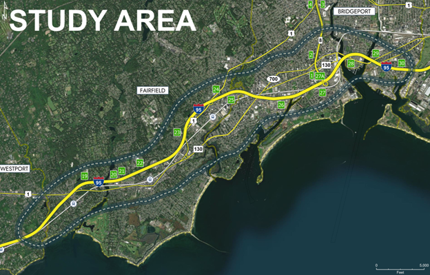
Study Area
The Connecticut Department of Transportation (CTDOT) is performing a Planning and Environment Linkages (PEL) Study to explore ways to improve mobility and travel conditions along the I-95 corridor in Fairfield and Bridgeport. I-95 in Fairfield and Bridgeport is one of the most heavily traveled roadways in the state and carries approximately 120,000-130,000 vehicles per day. Post Road and Kings Highway (US Route 1) in Fairfield and State Street (Route 130) and Fairfield Avenue (State Road 700) in Bridgeport add to the daily traffic within the corridor. In addition to car and truck traffic, rail (Metro North Railroad and Amtrak), buses, bicyclists, and pedestrians travel within the corridor every day.
PEL Study - An Important Step
Undertaking this mobility study is an important step toward real corridor improvement projects. The Planning and Environment Linkages (PEL) process that is being followed will link the planning efforts of the communities and planning organizations with specific proposed transportation projects that will have to go through future environmental review under the Federal and/or Connecticut regulations (National Environmental Policy Act (NEPA)/Connecticut Environmental Policy Act (CEPA)).
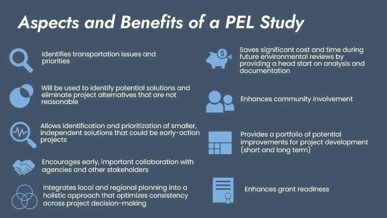
What does this mean? The PEL process is a planning effort that brings together members of the public that use or have an interest in the study area to consider the benefits and impacts of proposed transportation solutions.